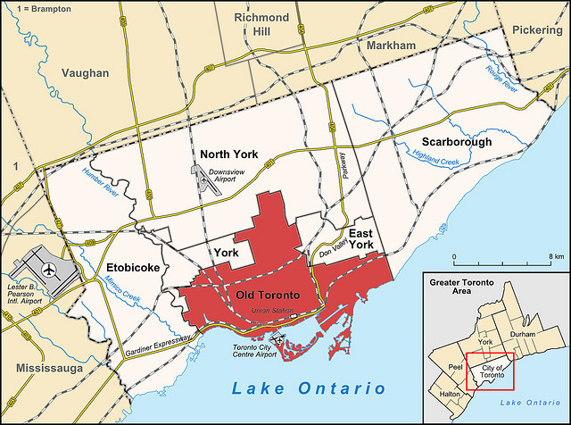
Map of Metropolitan Toronto (1954-1998) by randyfmcdonald|Published February 10, 2012-at dimensions 640 × 476 in Toronto’s Two Solitudes Images navigation Previous Next This map shows the borders of the six municipalities federated under the aegis of Metropolitan Toronto regional government until the six were formally fused in 1998.